Map reading Normal Social Studies Worksheets for Ages 5-9
3 filtered results
-
From - To
Introducing our "Map Reading Normal Social Studies Worksheets for Ages 5-9," designed to enhance geographic literacy and critical thinking in young learners. These engaging, printable worksheets from Kids Academy cater to elementary students, helping them understand maps, symbols, and basic navigation skills through fun activities and exercises. Ideal for both classroom and home use, these resources are perfect for developing early map-reading abilities. Empower your child with essential social studies knowledge and set the foundation for future geographic exploration. Visit Kids Academy today to explore and download our map reading worksheets for young geographers!

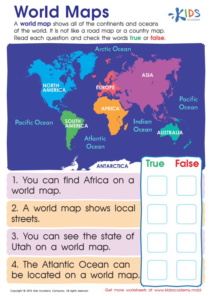
World Maps Worksheet
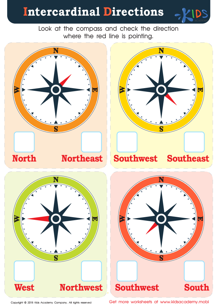
Intercardinal Directions Worksheet


Map reading plays a crucial role in the early social studies curriculum for children aged 5-9. It offers a multitude of benefits that parents and teachers should care about. First, map reading helps young learners develop spatial awareness. Understanding the concepts of direction, distance, and spatial relationships supports cognitive growth and problem-solving skills. Children learn to visualize spatial information, which is essential for everyday navigation and more complex geographical studies later on.
Second, map reading serves as a foundational skill in geography, enabling children to comprehend the world around them. Early exposure to maps fosters curiosity and creates a connection to various places, people, and cultures. This informs their understanding of community, nation, and global connections, nurturing a sense of belonging and global citizenship.
Moreover, map reading integrates math skills such as measurement and scaling. Students enhance their ability to interpret symbols and legends, which translates into better reading and comprehension abilities. Interpreting maps strengthens critical thinking, as children learn to analyze and draw conclusions based on visual data.
Lastly, map reading is engaging and interactive. Fun activities like treasure hunts or mapping the classroom immerse children in learning experiences that make abstract concepts tangible and memorable. All these reasons underscore the importance of early map reading in nurturing well-rounded, geographically aware, and critically thinking young learners.