3.1b Geography and Environment worksheets for Grade 3
5 filtered results
Difficulty Level
Grade
Age
-
From - To
Subject
Activity
Standards
3.1b
Globes, maps, photographs, and satellite images contain geographic information. Maps often have a title, legend or key, compass orientation, author, date, grid, and scale.
Favorites
With answer key
Interactive
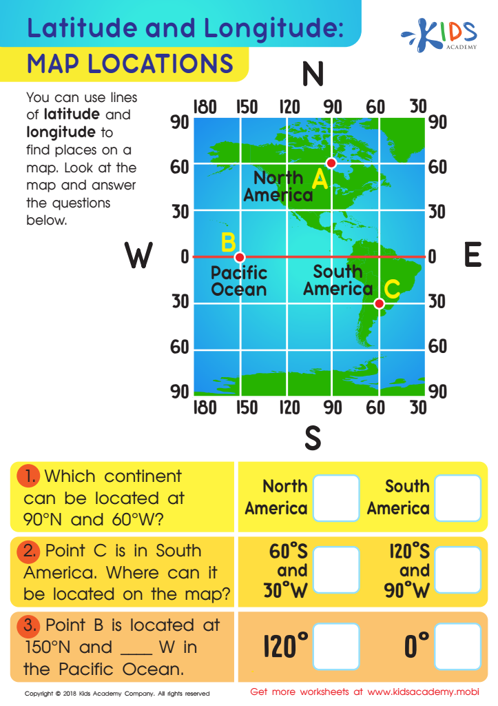
Latitude and Longitude: Map Locations Worksheet
This worksheet teaches young explorers about longitude and latitude using grid coords and a map. Kids gain practice finding answers to location questions and choosing the right answer from multiple choices. Acquiring geography skills while having fun like a strategy game!
Latitude and Longitude: Map Locations Worksheet
Worksheet
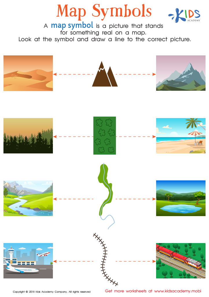
Map Symbols Worksheet
GPS may help us get around, but reading a map is still a valuable skill. It can help improve reading, visual discrimination and problem-solving. Try this free worksheet with your kids to help them understand map symbols and locate places. It's fun, and will strengthen their map-reading ability.
Map Symbols Worksheet
Worksheet
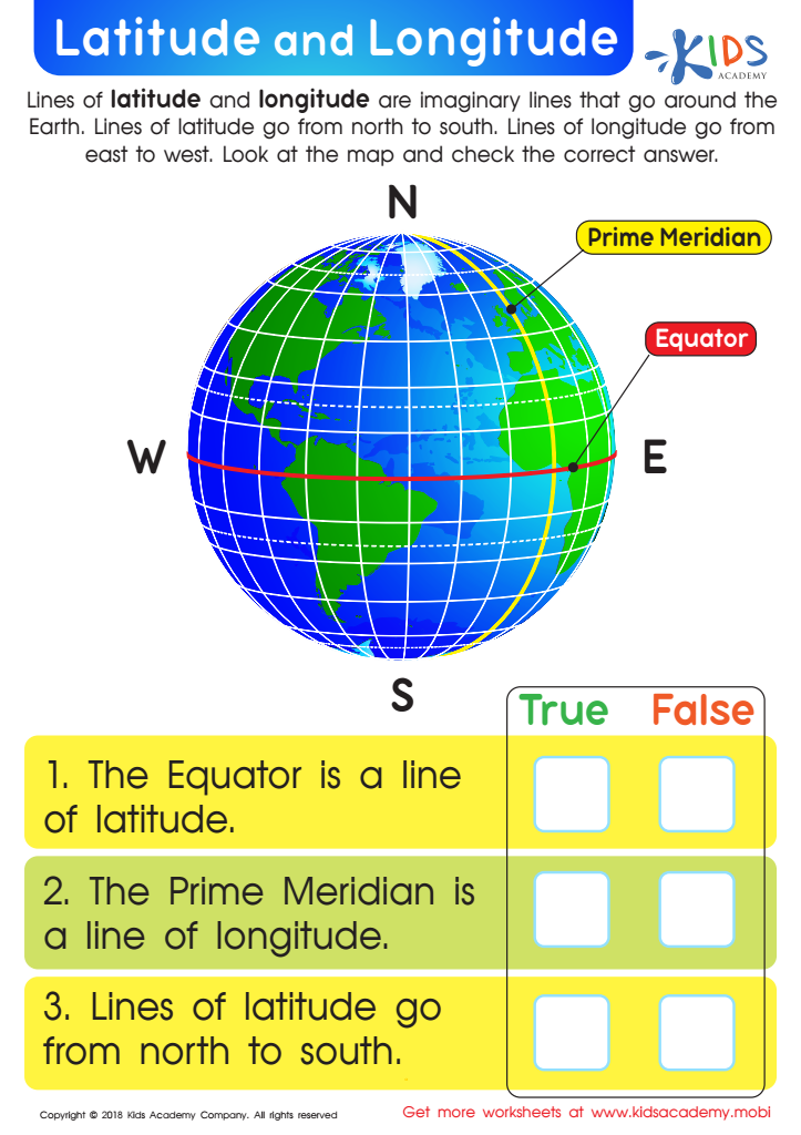
Latitude and Longitude Worksheet
Learning latitude and longitude can be challenging. This free PDF worksheet helps students understand the Equator, Prime Meridian, and lines of latitude and longitude. Questions help you assess their concept connection. It's an essential skill and an essential base for further geography studies.
Latitude and Longitude Worksheet
Worksheet
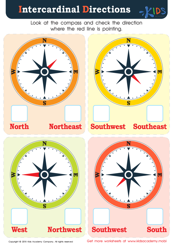
Intercardinal Directions Worksheet
Young students often don't get to practice cardinal and intercardinal directions in the digital age, but it's an important social studies and geography concept to learn. This PDF provides colorful compasses for them to practice with, giving them a real-world skill for common curriculum and independent living.
Intercardinal Directions Worksheet
Worksheet
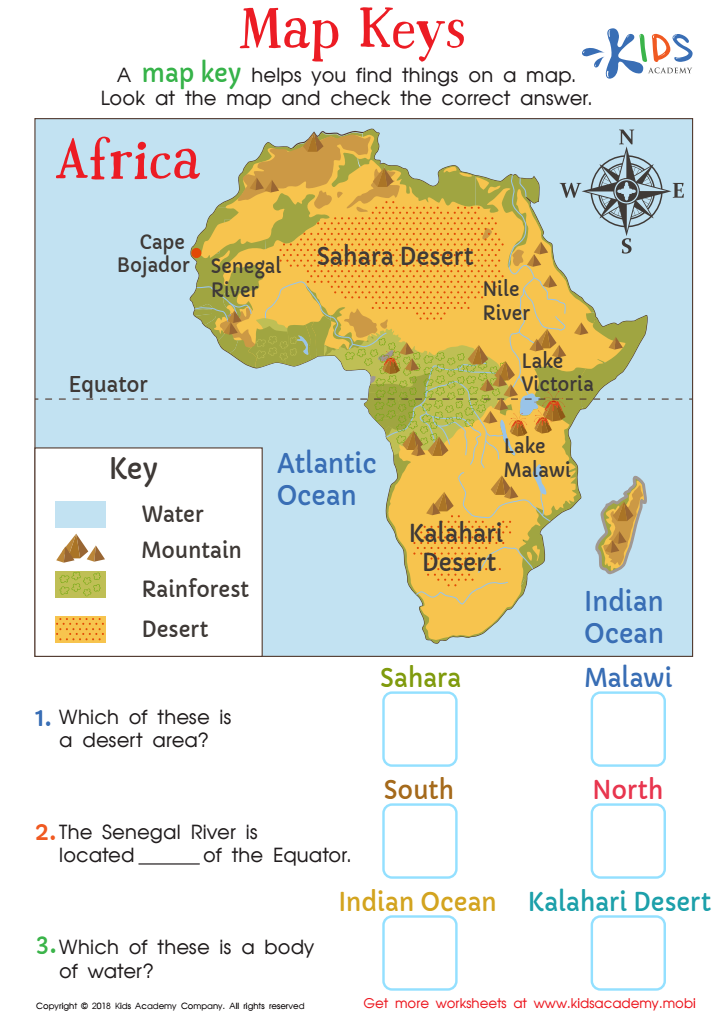
Map Keys Worksheet
Kids today use electronic devices for directions, but map reading and map keys are important skills. This PDF worksheet introduces students to a map of Africa, and helps them link map symbols in a key with the destinations. They can use the key to answer the questions and get a feel for a real safari!
Map Keys Worksheet
Worksheet